Welcome

I'm Ashraf

Applied Geophysicist & ML Researcher

M.Sc.(Tech.) Applied Geophysics · IIT (ISM) Dhanbad
Building data-driven solutions for subsurface characterization, petrophysics, and geophysical interpretation.
Md Ashraf Ali, Applied Geophysics student at IIT (ISM) Dhanbad

About

Applied Geophysicist | Geoscience & Data Analytics

I'm an Applied Geophysicist with an MSc (Tech) in Applied Geophysics from IIT (ISM) Dhanbad. I combine geoscientific knowledge with computational methods to understand subsurface systems and solve practical geoscience problems.

My experience and projects span seismic data analysis, well-log interpretation, petrophysical evaluation, and machine learning applications in geoscience. I have also worked on earthquake deformation analysis using GPS data and developed Python-based tools for petrophysical interpretation and scientific data analysis.

I'm particularly interested in subsurface characterization, exploration geophysics, and data-driven workflows that connect geological understanding with computational problem-solving.

Areas of Expertise
Seismic Geophysics Well Log Analysis Petrophysics Python & Machine Learning Subsurface Characterization
  • Location: Bengaluru, India
  • Education: MSc (Tech), Applied Geophysics
  • Institution: IIT (ISM) Dhanbad
Expertise

Technical Competencies

Interdisciplinary domain knowledge bridging geophysical data acquisition, seismic processing, well log interpretation, and modern scientific computing.

Geophysics & Subsurface Software

DecisionSpace (Landmark) Hampson-Russell Seismic Unix Tesseral GAMIT/GLOBK GMT (Generic Mapping Tools) Petrel (Basics)

Machine Learning & AI

Scikit-learn XGBoost Random Forest Support Vector Machines (SVM) Self-Organizing Maps (SOM) HDBSCAN Gradient Boosting TensorFlow / PyTorch

Programming & Development

Python 3.x (Advanced) PyQt5 GUI Dev MATLAB HTML5 / CSS3 JavaScript Bash / Shell SQL

Data Science & Petrophysics

NumPy & SciPy Pandas Matplotlib & Seaborn Lasio (LAS Log I/O) Outlier Detection Archie's Water Saturation (Sw) Vshale & Porosity Modeling Plotly

Tools & Environment

Linux / Unix Environment Git & GitHub LaTeX VS Code MS Excel (Data Modeling) MS PowerPoint & Word

Research & Geoscientific Analysis

Earthquake Declustering Seismic Reflection Processing Well-to-Seismic Tie Co-seismic GPS Geodesy Lithofacies Classification Scientific Documentation Problem Solving & Adaptability

Education

  • 2023-2026

    Msc Tech (Applied-Geophysics)

    IIT (ISM) Dhanbad
  • 2019-2022

    B.Sc Physics (Hons)

    Patna Science College, Patna University
  • 2019

    Intermediate

    +2 Islamia High School, Simri Bakhtiyarpur
  • 2017

    Matriculation

    +2 Islamia High School, Simri Bakhtiyarpur

Experience

  • December 2024

    GeoPhysical Field Training

    IIT (ISM) Dhanbad

    Hands-on field acquisition and interpretation across electrical resistivity tomography (ERT), shallow seismic refraction, gravity, and magnetic survey methods.

  • June 2024

    Training on Glacier Studies and Remote Sensing

    Divecha Centre for Climate Change, IISc Bangalore

    Focused on glaciology, including glacier and snow cover distribution, remote sensing, and climate change impacts. Experienced in performing topographic reflectance corrections, estimating glacier depth, and evaluating climate-related impacts

  • December 2023

    Geological Field Training

    Indian Institute of Technology(ISM),Dhanbad

    Map orientation,Front and Back bearing, Analysis of rock types and mineralogy, Assessment of rock strength with related tests, and measurement of dip and strike of geological structures.

Featured Work

Flagship Projects & Research

Scientific computing, desktop petrophysics software development, and machine learning research applied to subsurface exploration and earthquake seismology.

🛢️ Flagship Desktop Suite PyQt5 / Python
IIT (ISM) Dhanbad · Product Development

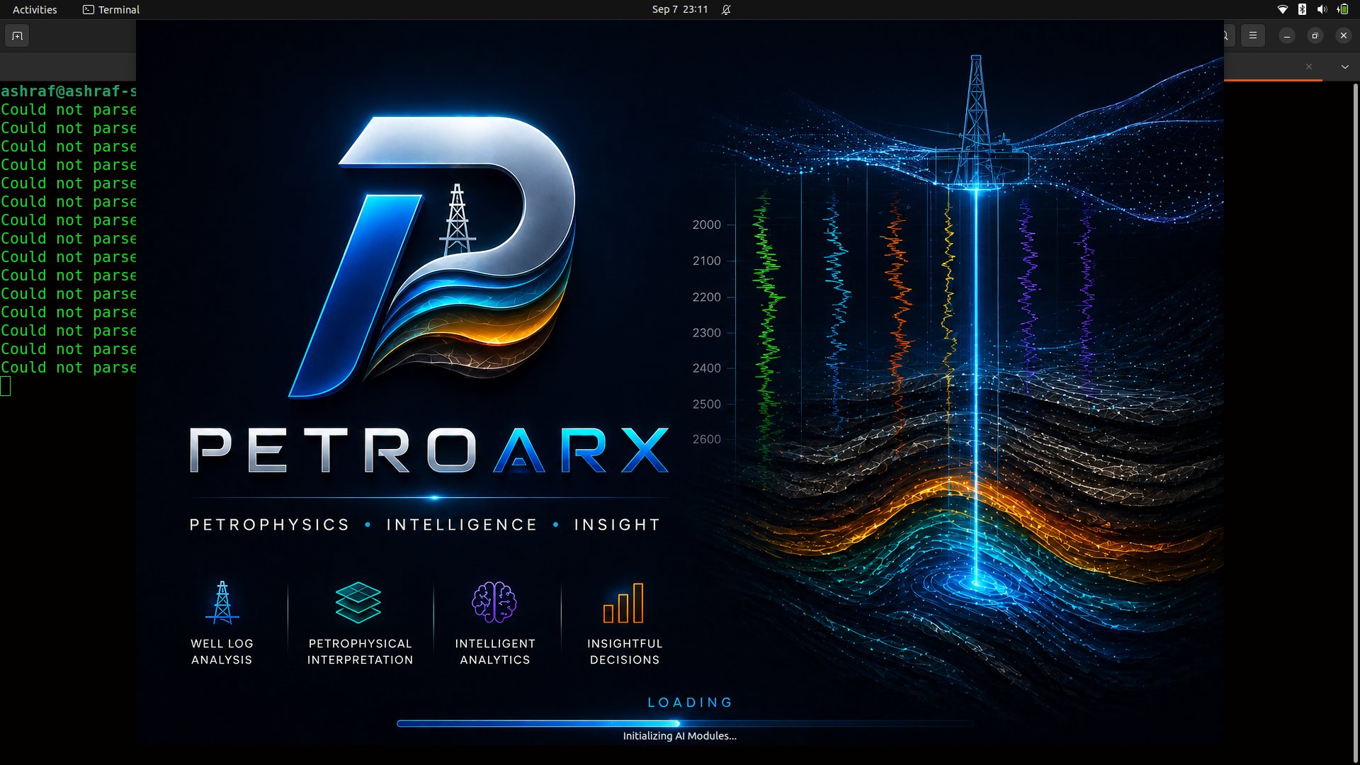
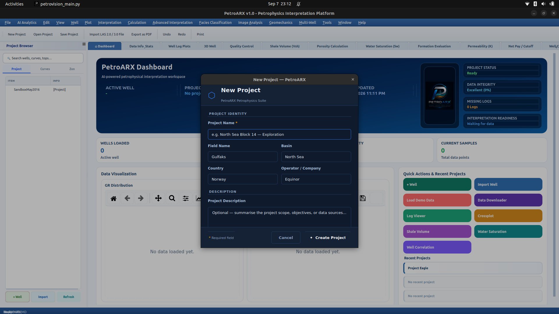
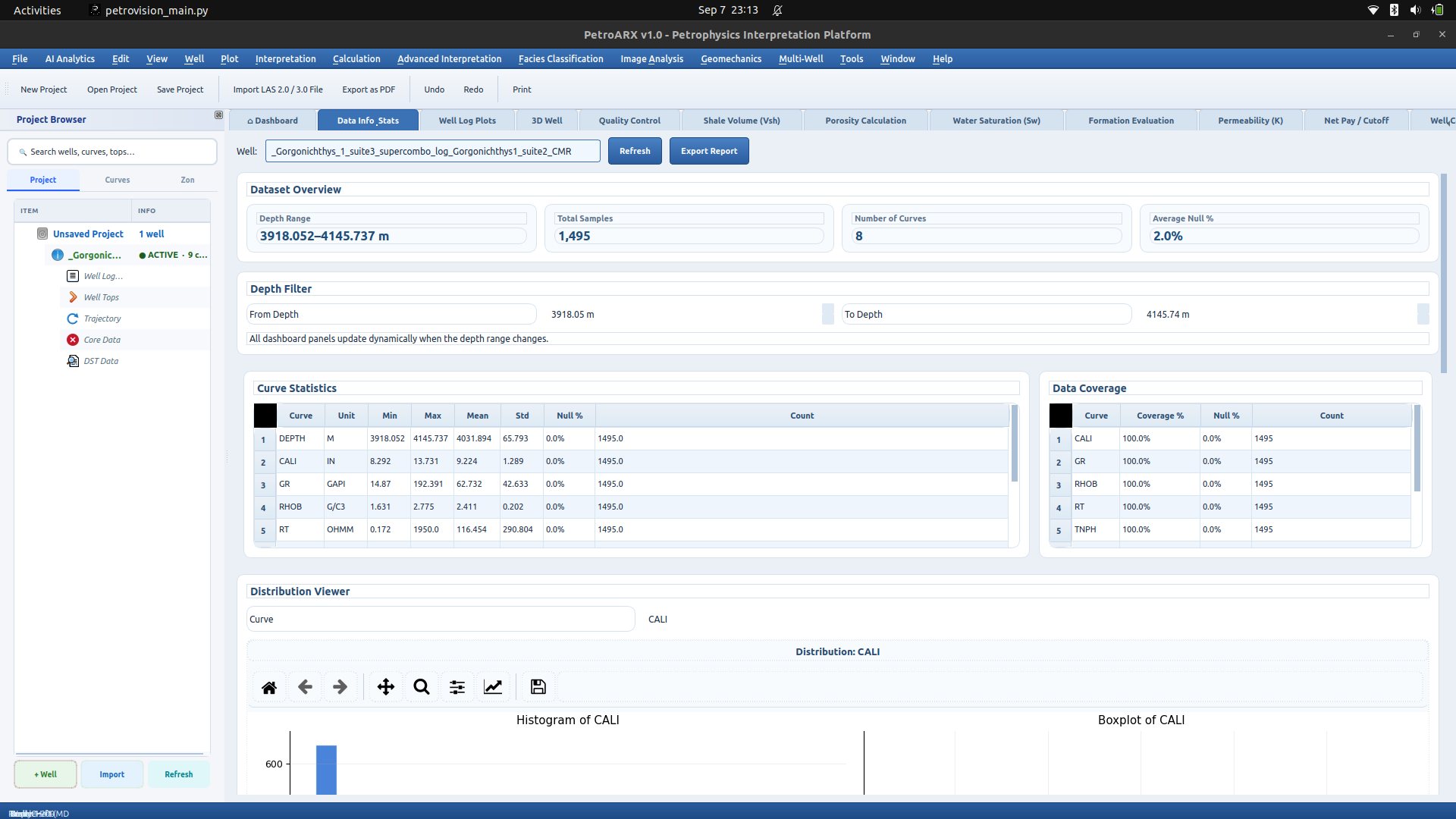
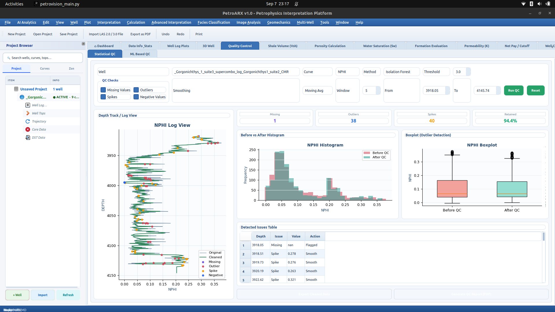
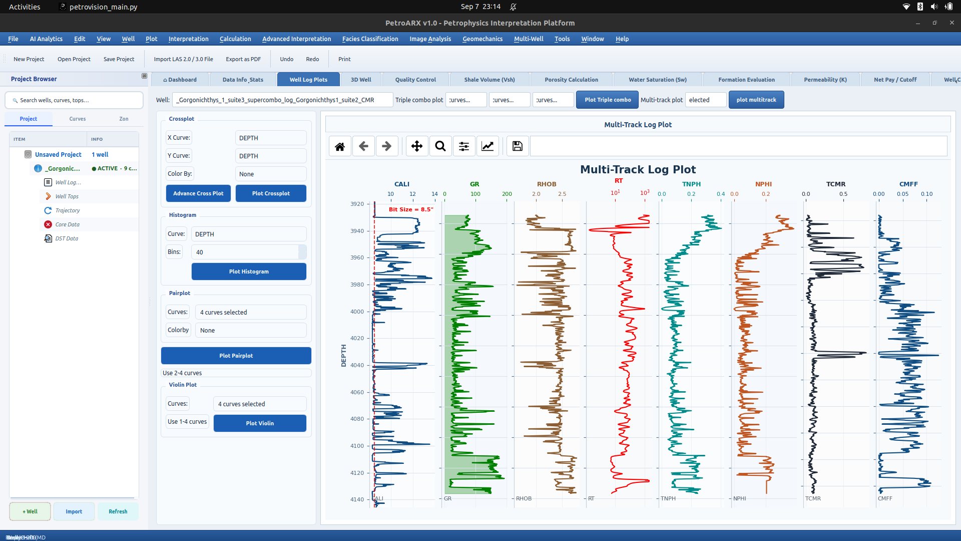
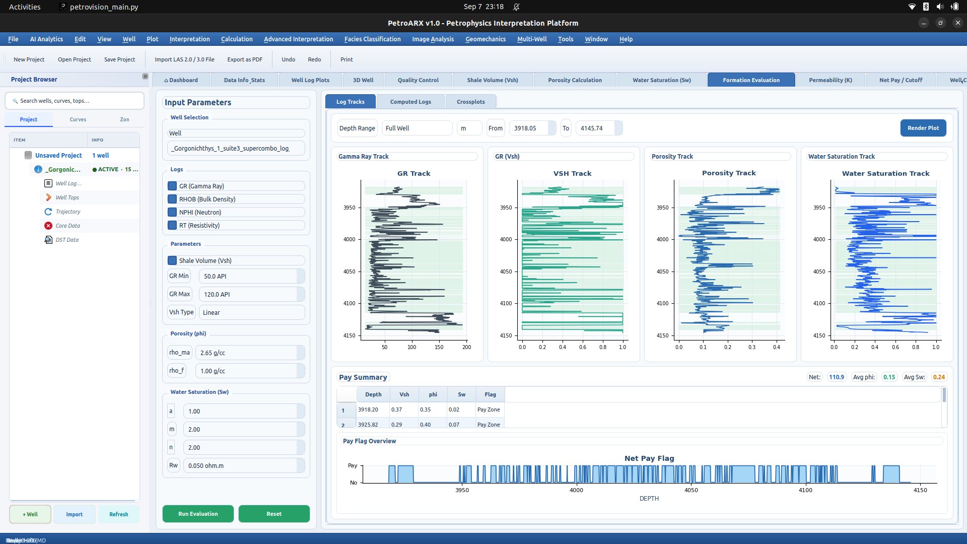
PetroARX — Desktop Petrophysics & Subsurface Analytics Suite

A comprehensive desktop geoscience platform engineered from scratch using Python and PyQt5 for advanced petrophysical evaluation, multi-well correlation, and 3D wellbore trajectory visualization. Built to provide explorationists with an intuitive, Schlumberger Petrel/Techlog-inspired analytical workstation for raw wireline log interpretation.

Key Functional Modules:

  • 3D Wellbore Tube Renderer: 3D trajectory calculation with Bishop framing for spatial deviation and continuous color-mapped gamma ray and resistivity logs.
  • Multi-Well Correlation: Simultaneous multi-well stratigraphic log tracks, datum alignment, and automated marker correlation.
  • Wireline Log Quality Control (QC): Outlier filtering, histogram distribution analysis, and multi-sensor drift detection algorithms.
  • Automated Lithofacies Prediction: Integrated ML models for automated electrofacies mapping directly from raw log curves (GR, NPHI, RHOB, DT).
  • Quantitative Petrophysics Engine: Automated computation of Archie’s water saturation (Sw), shale volume (Vsh), effective porosity, and real-time parameter sensitivity.
  • Robust I/O: Full LAS 2.0/3.0 parser, CSV/XLSX export, and publication-ready vector graphic generation.
Python 3.x PyQt5 Qt Designer NumPy SciPy Pandas Matplotlib Lasio Seaborn Scikit-learn
🏆 Accepted at ICSAE 2025 · Paper ID: ICSAE2025-11005 Master's Thesis Research
IIT (ISM) Dhanbad · 2024–2025

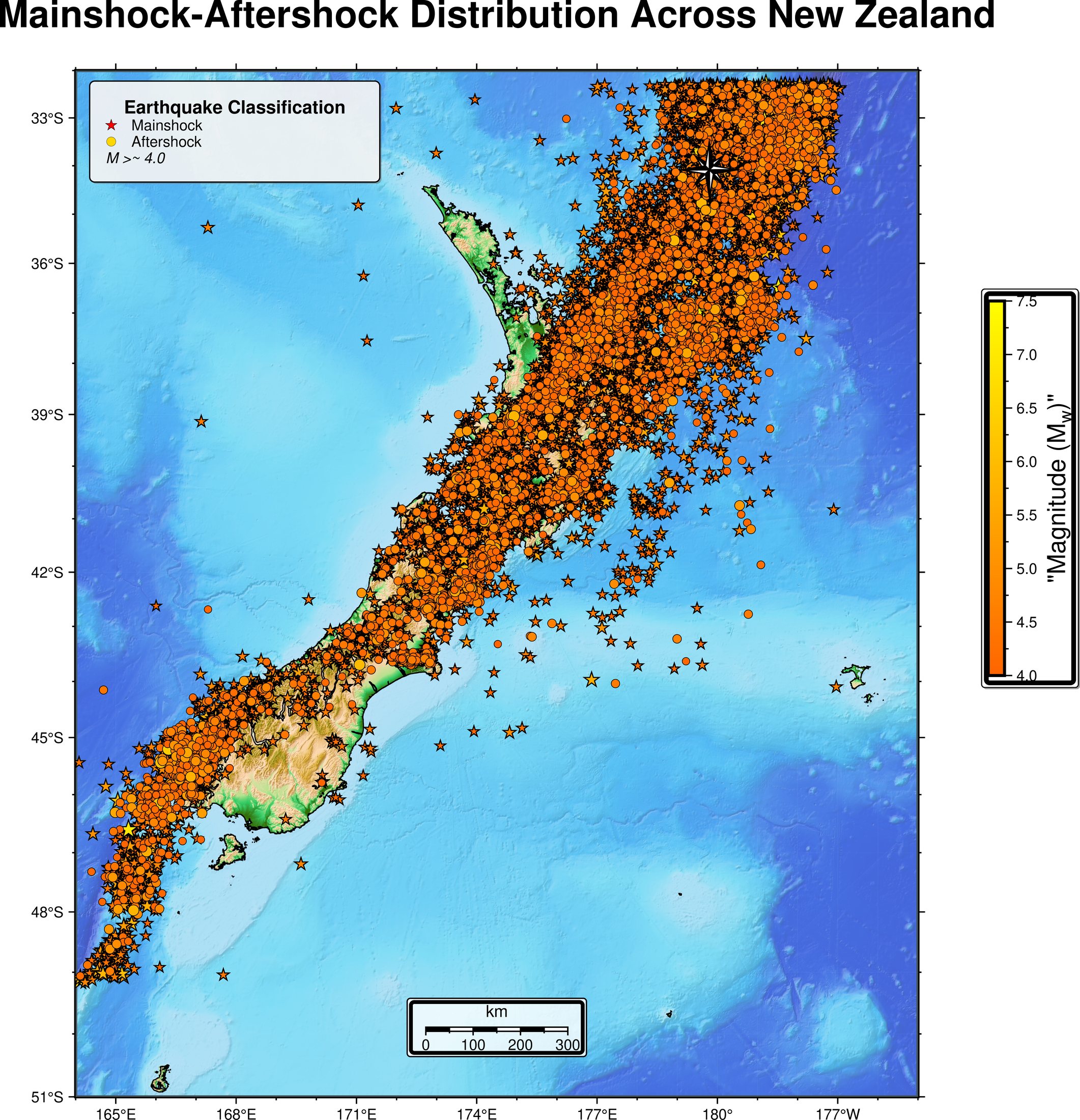
Machine Learning Approaches for Earthquake Declustering

Master's research establishing data-driven machine learning methodologies for earthquake catalogue declustering — disentangling triggered aftershocks and foreshock sequences from stationary Poissonian background seismicity to significantly advance seismic hazard assessment and probabilistic forecasting.

  • Catalogue Benchmark: Investigated high-density earthquake catalogues from the New Zealand GeoNet network across complex strike-slip and subduction zones.
  • Supervised Benchmarking: Implemented and compared XGBoost, Random Forest, Support Vector Machines (SVM), and Gradient Boosting classifiers against conventional deterministic windowing (Gardner-Knopoff, Reasenberg).
  • Unsupervised & Hybrid Ensembles: Developed unsupervised spatial clustering using Self-Organizing Maps (SOM), HDBSCAN, and a novel SOM+DBSCAN hybrid pipeline for adaptive spatiotemporal cluster boundary resolution.
  • Statistical Seismology Validation: Evaluated seismicity catalogue completeness (Mc), b-value spatial stability, and modified Omori law aftershock decay rates.
Python Scikit-learn XGBoost HDBSCAN MiniSom GeoNet API NumPy & Pandas Matplotlib & Seaborn Statistical Seismology

Outcome

  • 97.44% classification accuracy (XGBoost, on synthetic test data), with an ROC AUC of 0.98.
  • Catalogue separated into 230,758 background events (58.23%) and 165,509 triggered events (41.77%).

Full methodology, figures and per-model scores are on the earthquake declustering results page.

🌐 Seismic Interpretation Seismic Computing
Geophysical Software

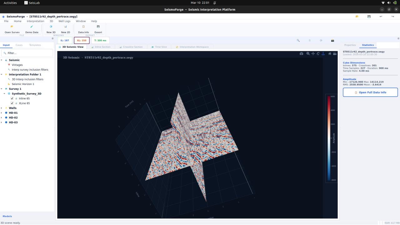
SeismoForge — Seismic Visualization & Interpretation Platform

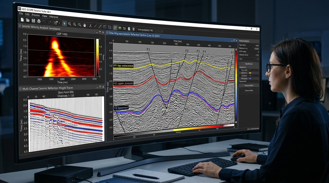
A Python-based geophysical interpretation application developed for interactive visualization and analysis of seismic data. The platform supports SEG-Y datasets, 2D seismic sections, 3D seismic volumes, trace navigation, amplitude visualization, and seismic attribute analysis for subsurface interpretation.

  • 2D & 3D Seismic Visualization: Interactive visualization of SEG-Y seismic datasets with trace navigation, zooming, amplitude scaling, and seismic volume inspection.
  • Seismic Attribute Analysis: Computes RMS amplitude, instantaneous amplitude, phase, and frequency attributes to highlight subsurface structures and stratigraphic variations.
  • Interactive Interpretation Workflow: Provides an intuitive GUI for seismic data inspection and interpretation, with a modular architecture supporting future geophysical processing workflows.
Python PyQt5 NumPy Matplotlib SEG-Y Processing Seismic Attributes
Pair plot of well-log features used for facies classification

Machine Learning for Electrofacies Classification Using Well Logs

IIT (ISM) Dhanbad

March 2025 – April 2025

A research-driven case study applying both supervised and unsupervised ML techniques for automated electrofacies prediction from wireline well logs. Focused on robust feature engineering, model comparison, and validation against lithofacies core data and adjacent wells.

  • Analyzed well log data using histograms to study distribution and detect outliers.
  • Created missing PE logs to support facies type identification in wells lacking that information.
  • Engineered secondary features for both supervised and unsupervised rock classification approaches.
  • Implemented supervised and unsupervised algorithms to classify electrofacies with high concordance.
  • Validated predicted facies by comparing with known lithofacies core reports and nearby well data.
Python Scikit-learn XGBoost NumPy Pandas Matplotlib Seaborn

Seismic Exploration Techniques: Acquisition, Processing & Interpretation

ONGC Chennai · Mentor: Dr. M Nagendra Babu — Sr. Geophysicist (Surface)

June 2024 – July 2024
  • Studied design and implementation of 2D/3D seismic surveys including geometry, shot/receiver placement, and field QC.
  • Performed seismic preprocessing workflows: deconvolution, bandpass filtering, velocity semblance analysis, NMO correction, stacking, and migration.
  • Applied seismic interpretation workflows in DecisionSpace (Landmark) and Hampson-Russell for structural and stratigraphic analysis.
  • Interpreted seismic profiles to resolve fault geometries, anticlinal traps, and depositional unconformities.
DecisionSpace (Landmark) Hampson-Russell Seismic Unix Velocity Modeling Seismic-to-Well Tie

Co-seismic Surface Deformation Estimation using GPS Measurements

IISc Bangalore · Divecha Centre for Climate Change

May 2024 – July 2024
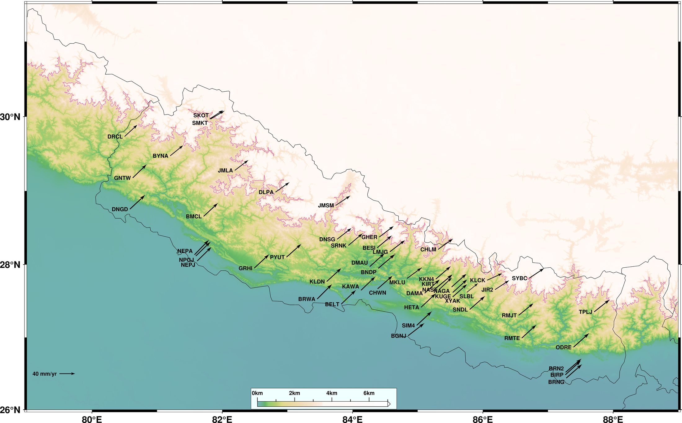
  • Investigated the 2015 Gorkha earthquake's crustal deformation field and GPS site velocities using GAMIT/GLOBK.
  • Processed continuous GPS geodetic data from 26 GNSS and 12 IGS stations spanning 2010–2016.
  • Generated earthquake movement-related time-series displacements and computed slip distribution vectors.
  • Handled RINEX file format conversion and automated coordinate baseline estimation scripts.
GAMIT/GLOBK GMT (Generic Mapping Tools) GNSS Geodesy Crustal Kinematics

Petrophysical Case Study of Gorgonichthys-1 Well

IIT (ISM) Dhanbad

March 2024 – April 2024

Comprehensive petrophysical evaluation of the Gorgonichthys-1 exploration well, focusing on sonic tool design, wireline log quality control, porosity derivation, velocity analysis, shale volume estimation, and hydrocarbon pay zone determination.

Read Full Summary & Methodology

Detailed Investigation Steps:

  • Wireline log QC: statistical sanity checks, environmental corrections, and outlier filtering.
  • Cross-plot analysis: density-neutron lithology identification and mineral volume estimation.
  • Acoustic velocity analysis: compressional and shear wave travel time calibration.
  • Shale volume determination: linear and non-linear (Larionov, Clavier) gamma-ray formulations.
  • Water saturation evaluation (Sw): Archie and Simandoux shaly-sand equations for net pay flags.

Tools: Python, Matplotlib, NumPy, LAS data processing

Leadership & Service

Positions of Responsibility

EAGE logo

EAGE IIT ISM Student Chapter

Content Writer

Technical geoscience content writing, event editorial, and geophysics student outreach.

SEG logo

SEG Student Chapter

Content Writer

Exploration geophysics articles, technical workshops, and chapter documentation.

Chegg logo

Chegg (EdTech)

Subject Matter Expert

Expert physics guidance, advanced problem solving, and academic quality assurance.

Honors & Recognition

Key Academic Achievements

Recognized for national academic entrance rankings, premier competitive fellowships, and research excellence.

AIR-11

AIR-11 in JMI M.Sc. Entrance

Achieved an exceptional All-India Rank of 11 in the nationwide entrance test for Jamia Millia Islamia's M.Sc. Physics program.

Govt. of India

DST-Inspire Scholar

Awarded the prestigious national fellowship by the Department of Science & Technology (DST), Govt. of India for academic merit.

1st Place

University Essay Winner: Physics

Winner of the university-wide scientific essay competition on "Recent Developments in Physics" (2022) across departments.

Certifications

Certifications & Technical Training

Verified credentials and technical training across subsurface software, petrophysics, remote sensing and GIS, and scientific computing — every entry links to the issuing body’s certificate.

Featured Technical Credentials

Training most directly applicable to subsurface and geoscience work.

See all certifications

All Certifications & Training

Complete list of certifications, courses and technical training.

Professional Certificate · with Honors

Machine Learning with Python

Supervised and unsupervised learning, classification, regression, clustering and model evaluation with scikit-learn.

  • Python
  • Machine Learning
  • Scikit-learn

IBM · Coursera

Completed 11 Jan 2024

Government Programme

RS & GIS Applications in Natural Resource Management

Spatial data modelling, thematic land-use classification, hydrology and digital elevation model analysis.

  • Remote Sensing
  • GIS
  • DEM Analysis

IIRS, ISRO · nodal centre IIT (ISM) Dhanbad

06–17 Nov 2023 · 15 hrs · 90% attendance

Professional Certificate

Python for Data Science, AI & Development

Applied data science pipelines with NumPy and Pandas, REST APIs, web scraping and automated data-wrangling workflows.

  • Python
  • Pandas
  • APIs

IBM · Coursera

Completed 26 Dec 2023

Online Course

Programming for Everybody (Getting Started with Python)

Core computational algorithms, data structures, control flow, functions and programmatic file processing.

  • Python
  • Programming
  • Data Structures

University of Michigan · Coursera

Completed 03 Dec 2023

Government Programme

Geodata Processing using Python

Raster and vector spatial processing with GDAL, Shapely and GeoPandas, and automated satellite-data pipelines.

  • Python
  • GDAL
  • GeoPandas

IIRS, ISRO · nodal centre IIT (ISM) Dhanbad

15–19 Jan 2024 · 100% attendance

Continuously building the bridge between geoscience and data science — new training is added here as it is completed.

“Learning never exhausts the mind.” — Leonardo da Vinci
Get in touch

Let's Build
Something Meaningful

Have a question, a collaboration in mind, or just want to talk about geophysics, data, or ideas?
I’d love to hear from you.

Send a Message

Fill out the form below and I’ll get back to you as soon as possible.

0/500

Your information is safe with me. I’ll never share your details.

Open to
CollaborationsResearch, academic or industry projects
Ideas & DiscussionsGeophysics, AI/ML, data science & more
OpportunitiesInternships, full-time roles, or consulting
Just a HelloAlways happy to connect with people
Based in Dhanbad, India

Always open to remote collaborations across the globe.